U_CAN aims to bridge knowledge and expertise gaps in Ukrainian cities to help them achieve climate neutrality by 2050. This involves strategic cooperation between EU expert partners and Ukrainian stakeholders to develop comprehensive green strategies and enhance local capacities.
Project Information Card
| Project name: | UkHumanitarian Mine Action with Advanced Tech and Multi-Criteria Risk Assessment |
| number: | 5G7205 |
| Project term: | 2025 |
| donor: | NATO |
| cooperation program: | NATO SPS |
| Grantholder: | Igor Sikorsky Kyiv Polytechnic Institute National Technical University of Ukraine “Igor Sikorsky Kyiv Polytechnic Institute” |
| responsible person: | Oksana Vovk oksanavovk76@gmail.com |
Purpose and objectives of the project:
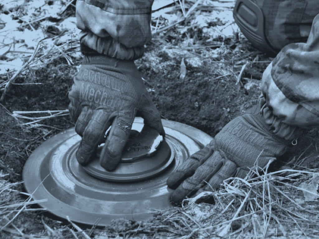
Humanitarian Mine Action (HMA) is critical in post-conflict areas, ensuring the safety of local populations and facilitating the return of land for agricultural, residential, and economic use. Advanced technology and multi-criteria risk assessment (MCRA) methods are transforming the way landmines and unexploded ordnance (UXO) are identified, assessed, and removed.
Expected results:
Advanced Technology in Humanitarian Mine Action
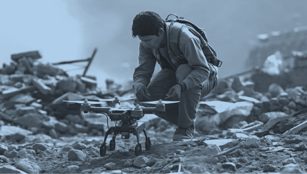
Remote Sensing and Drones: Drones equipped with high-resolution cameras, LiDAR, and thermal imaging can identify potential minefields without putting personnel at risk. Aerial surveys help in mapping large areas quickly, creating detailed 3D models of terrain that may indicate disturbed ground or signs of explosive remnants of war (ERW).
Ground Penetrating Radar (GPR): GPR systems can be deployed on the ground to detect buried mines and UXOs by emitting radar waves that penetrate the soil and reflect off objects beneath the surface. This method is often used in conjunction with manual demining teams to verify and locate threats.
Robots and Unmanned Ground Vehicles (UGVs): Autonomous robots can be sent into potentially dangerous areas, where they use sensors, cameras, and other detection technologies to locate and neutralize mines, minimizing human exposure to danger.
Artificial Intelligence (AI) and Machine Learning (ML): AI can analyze the data from drones, GPR, and other sensors to help identify mine patterns and predict where hazards are likely to be. These algorithms can be used to optimize demining routes, improve detection accuracy, and even guide decision-making in real-time.
Multi-Criteria Risk Assessment (MCRA)
MCRA is a decision-making tool used to evaluate risks by considering multiple factors, including social, environmental, and technical aspects. When applied to mine action, MCRA involves:
Hazard Mapping: Identifying and mapping high-risk areas based on historical conflict data, terrain, proximity to populated areas, and environmental conditions.
Vulnerability Assessment: Evaluating the local population’s vulnerability to landmines, including the number of people living in or near high-risk areas, their access to education about mine risks, and the availability of emergency services.
Effectiveness of Intervention: Assessing the impact of mine clearance efforts based on technological capabilities, the speed of deployment, and the resources available. This helps prioritize areas where clearing mines will have the most significant benefit.
Cost-Benefit Analysis: Weighing the costs of using advanced technologies (drones, robots, etc.) against the benefits, such as saving lives, returning land to productive use, and reducing the long-term socioeconomic impact of landmines.
By integrating advanced technology with MCRA, humanitarian mine action can become more efficient, cost-effective, and safer, ultimately accelerating the recovery of affected areas. This approach not only helps clear land but also ensures that demining efforts are targeted in ways that maximize community safety and long-term benefits.